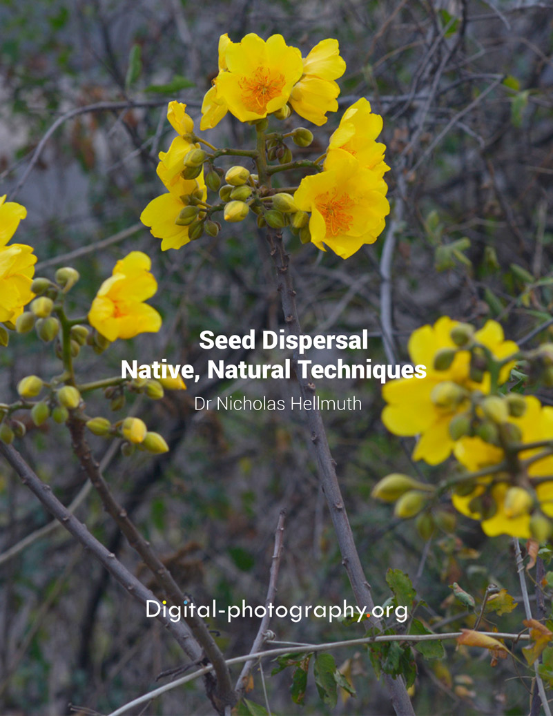
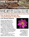
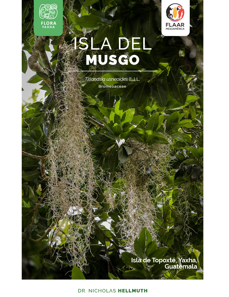
Laguna Grande is a lagoon found in the Río Sarstún area. On our first expedition day in October we sailed along the shore to document the species of flora and fauna that inhabit the place. Calliandra (Calliandra houstoniana) was one of the most photogenic flowers we found. This flower is color red and with the air you can see how its stamens fly, that is why it is normally angel hair, old man's beard, angel head, cinnamon stick, cinnamon, coquito or angel grass (names in Spanish).
Calliandra houstoniana is a shrub that grows on the edges of plots and banks of some bodies of water both in the tropics and in temperate parts, in areas with an average annual temperature between 22 and 28 ° C. It is a native plant of Mexico and Central America. This plant belonging to the Fabaceae family, however, its genus is still under discussion as it is also related to the genera Acacia, Anneslia and even Mimosa.
It is used for shade in coffee plantations and in agroforestry systems, as livestock feed, green manure and a source of firewood. The bark is considered medicinal
Calliandra (Calliandra houstoniana) at Laguna Grande, Rio Sarstun, Livingston. October, 2021. Photo by Dr. Nicholas Hellmuth, FLAAR Mesoamerica.
Botanical Description
Habit
Shrub
Size
Up to 6m high.
Stem
Few thin erect branches where it blooms.
Leaves
Alternate up to 25 cm long, composed of rachis with up to 5 to 15 pairs of secondary axes with narrow leaflets of up to 11mm.
Inflorescence
Set of 3 to 5 sessile flowers in the form of a terminal panicle.
Flowers
Showy red stamens, thicker red style, white miniature petals.
Fruits and seeds
Legumes up to 12cm reddish brown covered with trichomes with oblong, flattened seeds.
Written by Vivian Hurtado & Roxana Leal Identified Species by Victor Mendoza
After accomplishing research with the co-administrators and park rangers of Parque Nacional Yaxha, Nakum and Naranjo (PNYNN) from August 2018 through July 2019 we were asked to return for a larger project of cooperation and coordination with CONAP in this park plus adjacent parks and biotope nature reserves plus the overall Reserva de la Biosfera Maya.
So for the first year of this new flora, fauna, and ecosystem research project we are visiting different areas one by one to help us plan the subsequent years. We have done field trips to Cerro Cahui, Bio Itza, Biotopo San Miguel la Palotada and the southeast part of Parque Nacional Laguna del Tigre. We go with local people on each field trip since this is a project of cooperation and coordination and we visit with the administrators. There are several other national parks that we would like to assist when time and funding are available.
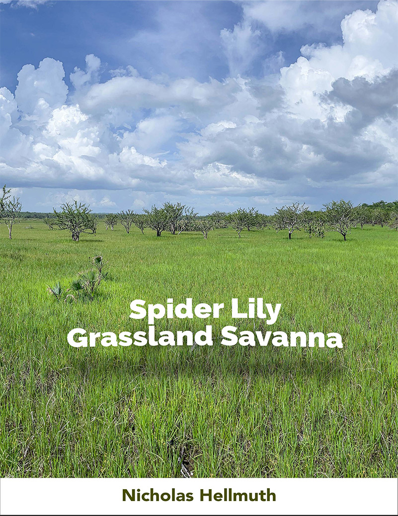
Today we would like to share with botanists, ecologists, and other interested professors, students and interested general public the initial results of first stage field work on seasonally inundated savannas. Bajo vegetation is already sell studied by multiple projects by Guatemalan archaeologists, ecologists and partners from universities in several other countries. Hillside and hilltop vegetation has been studied by Cyrus Lundell in the 1930’s, Dennis Puleston in the 1960’s, and lots of capable ecologists and archaeologists in recent decades. So we are focused on studying savannas, swamps, marshes, riversides, lakesides and other areas
These FLAAR reports are literally only the beginning of our dedicated coverage. I am especially interested in all plant species of these seasonally inundated areas. We also photograph any insect or other creature that we find.
All reports will also be published in Spanish as soon as possible.
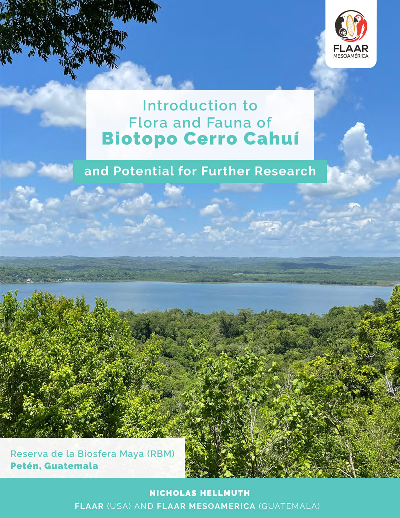
This report has one of our user-friendly maps to show you where Biotopo Cero Cahui is located and thus how you can easily get here.
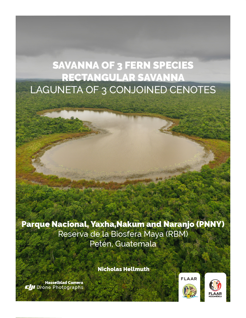
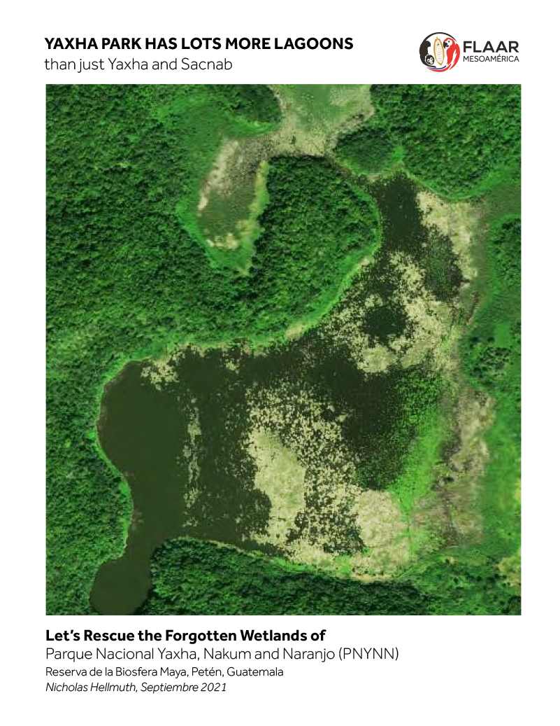
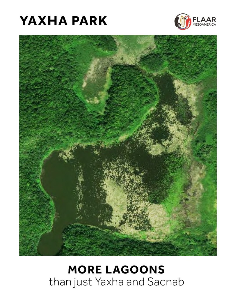
All the lakes, lagoons, and inlets in the chain from Laguna Sacnab to Laguna Champoxte at the far west of the park (PNYNN) have water levels that rise and fall. In dry years there are massive areas of former mud bottoms that turn into biodiverse fields of vegetation: we have found “cuscuta mimic savannas” of Cassytha filiformis on the south shore of Lake Yaxha and thick “morning glory vine fields” where the inlet named Laguneta Julequito is.
So we are featuring this inlet of Lake Yaxha on the front cover of our brief initial introduction to the unstudied lakes and lagoons at the southwest part of Parque Nacional Yaxha, Nakum and Naranjo.
This report will be replaced by new FLAAR reports using our fresh drone photos of:
Laguneta La Guitarra (Laguneta El Juleque)
Laguneta Lancaja (Laguneta Lancaha)
Laguneta Perdida (Laguneta of 3 Conjoined Cenotes) that we show in our report on the Savanna of 3 Fern Species
This coming week we will be accomplishing drone photography of the Southwest Cenote, the Northwest Cenote, Rio Ixtinto and the shore areas between and around them (so the far west end of Lake Yaxha). The middle and east ends of Lake Yaxha are so easy to see that they don’t need special reports at the moment.
16 page introduction to the lagoons, lagunetas west of Lake Yaxha and the inlet of Lake Yaxha (at its southwest part).
We show satellite views, printed government maps, and introductory bibliography to document which of these lagoons are missing from 90% of maps and 99% of ecological research projects.
Much more coming but we wanted to show what we are working on.
If you are interested in ethnobotany, Biotopo Cerro Cahai is a place with lots of different plants. For example, we found many edible cauliflorous fruits of Parmentiera aculeata, cuajilote. This tree fruits and flowers directly from the trunk. The flowers are similar size and unusual shape as the cauliflorous flowers of Crescentia cujete (jicara) and Crescentia alata (morro).
We include a list of 27 species of wild plants native to this part of the Reserva de la Biosfera Maya that are edible.
If you are a botanist, ecologist, archaeologist, and especially if working in Mesoamerica, this report is for you.
This report has one of our user-friendly maps to show you where Biotopo Cero Cahui is located and thus how you can easily get here.
Our 15-month project in the eastern half of Izabal area of Guatemala has evolved to focusing on wetlands vegetation and habitats: swamps, marshes, riverside ecosystems, lake and lagoon side ecosystems, and the biodiverse areas inland starting several meters from the Caribbean Beach (of Amatique Bay). This Municipio de Livingston area project has three more months before this phase is completed.
My immersion in wetlands of Izabal has motivated me to focus on wetlands of the Reserva de Biosfera Maya (RBM). The RBM is the entire northern half of Peten: from Lake Peten Itza at the south all the way up to the Peten-Campeche border at the north; and from the Peten-Chiapas border at the west across to the Peten-Belize border at the east.
Since savannas of RBM are seasonally inundated (as are the adjacent bajos, tintal areas that surround the grassland savannas), I am including savannas in our coverage of wetlands. We have documented several remarkable savannas during our 2018-2019 project in PNYNN (Parque Nacional Yaxha, Nakum and Naranjo). Now we continue there plus are expanding to cover the entire project area: Reserva de la Biosfera Maya (RBM). So in August we visited two savannas in the far southeast part of Parque Nacional Laguna del Tigre (PNLT). We focus on the far southeast because 99% of previous helpful ecological, botanical, and zoological research by other professors in this park has been at the west and northwest.
Today we wish to share the video of “Dr Nicholas” (Hellmuth) entering for the first time a grassland savanna never studied by any geographer, ecologist or botanist that we are aware of.
This was filmed by Boris Llamas and Andrea Bocamonte of FLAAR Mesoamerica and produced by Camila Morales of anima.works and expanded by video production specialist Sofia Monzon (who worked with FLAAR and with FLAAR Mesoamerica many past years).
Throughout the Chocón Machacas River you can find Callingcard vine (Entada polystachya) or in Spanish “bejuco de agua”, “bejuco Prieto”. It is a plant that seems to be very spongy and can be observed in 3 colors: green, white and brown. The buttons are green and when they open they turn white and brown. Its fruits are legumes, that means, pods. It is a plant with a foul odor.
Ecology: Tall climbing shrub, no spines present. The flowers are grouped and very flowered clusters are seen, depending on their stage of development, it turns into different colors. The fruits are pods that are 5 to 6cm wide.
Distribution: Native to tropical America. It lives in a warm climate between 550 and 800 meters above sea level. It is associated with disturbed vegetation derived from mangroves, tropical deciduous forest, grassland, and thorn forest. This means that it is a very adaptable plant to different ecosystems.
Ethnobotany uses: The ground seeds of this species are used to apply topically, it is used to prevent hair loss; the soaked root to wash the hair; and stem water in eye infections. A slightly sweet, pale yellow resin is obtained from the tree and sometimes it is used as a dye.
KINGDOM
Plantae
PHYLLO
Spermatophyta
CLASS
Magnoliopsida
ORDER
Fabales
FAMILY
Fabaceae
GENUS
Entada
SPECIES
Entada polystachya
References
BIBLIOTECA DIGITAL DE LA MEDICINA TRADICIONAL MEXICANA
2016
Atlas de las plantas de la medicina tradicional mexicana. Bejuco prieto (Entada polystachya)